Exploring historical maps can send you down a fascinating rabbit hole — especially when you’re trying to trace streets that existed before the interstate reshaped the city.
I’ve tried to pinpoint my grandmother’s childhood home on Rose Avenue, which, best I can tell, was near the old Sassy Ann’s, just south of the interstate in the Fourth and Gill neighborhood. Once upon a time, it was a bustling, close-knit community — straight out of the It’s a Wonderful Life era. I like to imagine her roller-skating down the sidewalks and walking to Old Knoxville High School with her older brother. The arrival of the interstate certainly changed the tempo of that neighborhood.
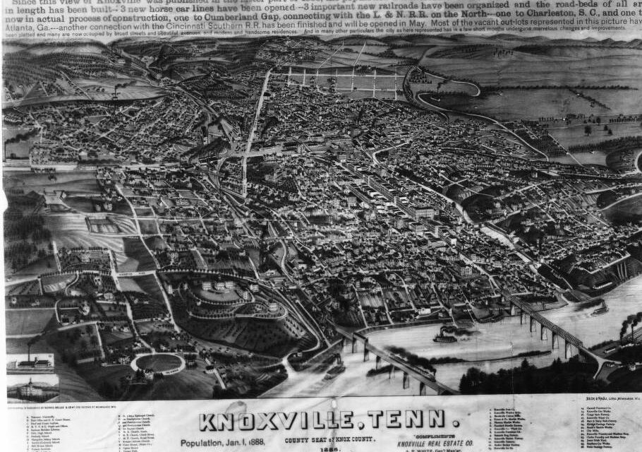
Fortunately, the Calvin M. McClung Historical Collection at the East Tennessee History Center offers thousands of maps to explore — on walls, in books, online and by request.
The collection spans Knoxville, East Tennessee, Southern Appalachia and beyond, covering nearly every kind of map you can imagine. Whether you’re researching your grandmother’s old neighborhood, tracking the evolution of downtown Knoxville, or studying Tennessee before it became a state, there’s something here for every history enthusiast. I particularly like the 1891 Cherokee addition map of what is now Sequoyah Hills. This one shows an early plan for the neighborhood, and it’s nothing like the current layout. Careful of that rabbit hole!
In this edition of the McClung Minute, we’re highlighting a few standout maps. Dive into our online collection and start your journey through time.

Great Smoky Mountains National Park, 1939; Published by the Miller Printing Company

Cherokee Addition, 1891, Supplement to the Knoxville Daily Tribune on Oct 18,1891
CORRECTION: The 1891 Cherokee addition map refers to the area that is now Cherokee Farms or the former UT Dairy Farm. I apologize for the mistake.
Mary Pom Claiborne is assistant director for marketing, communications and development for Knox County Public Library.
Follow KnoxTNToday on Facebook and Instagram. Get all KnoxTNToday articles in one place with our Free Newsletter.
Mary Pom, good article! However 1891 Cherokee addition map is not Sequoyah Hills. It’s what I always called UT’s Cherokee Farm – now know as The Research Park at Cherokee Farm.
Scott, thank you! I did some digging and you are correct. It is the current Cherokee Farms spot. Imagine our city had that development gone through. The bridge abutments are still there. I was thrown off by the “west Knoxville label on what appears to be the east side of the river. But it makes more sense the more I look at it.