That’s a head scratcher of a headline for a story about what is arguably Knoxville’s most exclusive neighborhood. But, were it not for the economic crisis known as the Panic of 1893, we might have a Looney’s Bend Industrial Park instead of a peninsula full of stately homes and a verdant boulevard with a beautiful riverside park.
Looney’s Bend was the name for the crescent in the Tennessee River (as well as the Looney Islands in the middle of it) and the adjoining land on the north bank for over a century. It earned its English name from one Moses Looney, about whom little is known and what is can be somewhat confusing. Suffice it to say, the Looneys were a big clan and more than one was named Moses.
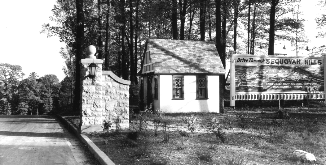
Come take a drive! Sequoyah Hills entrance, office and billboard, 1920s.
What is known about our Moses Looney is he owned considerable acreage along the river back when it was still called the Holston as it ran through and past Knoxville. Despite some sources that claim he attained all the property through a land grant, the largest chunk of it, 500 acres, was purchased for the sum of 115 British pounds in 1796 from Robert King of Hawkins County. King originally received the property from a North Carolina land grant, but apparently never lived on it. Around the time of this sale, Looney also received an additional 200 acres from a North Carolina land grant.
Over the course of the next several decades, Looney’s original acres were sold off. One of the last tracts, 129 acres, was acquired by Captain Jacob Lonas through his marriage to Pauline Sharp in 1871 and subsequently buying out the other Sharp heirs. In 1890, he sold that property to Francis Huger, who eventually accumulated 452 acres on behalf of a group of investors. A railroad man, the intent was to use the property as the relocation site of a New Jersey steel mill.
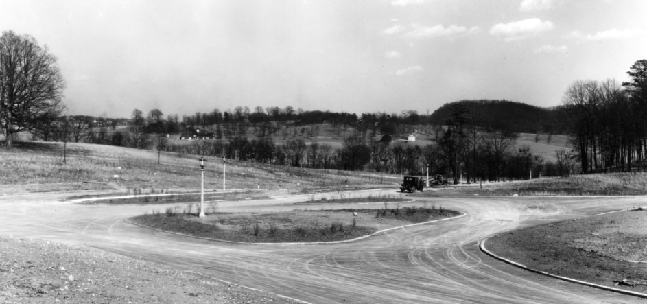
Can you imagine? If ever there was a silver lining to the economy turning upside down, the Panic of 1893, which crashed demand for steel, is what kept Sequoyah Hills from being developed for industry. The land was eventually divided among creditors in 1908. While there were families living in the area, mostly on farmland (the oldest house presently in the neighborhood was built in 1855), it still didn’t really start becoming what it is now until the 1920s.
In 1907, the original Cherokee Country Club was established on Lyons View Pike and later rebuilt in 1928. Street car lines were extended to Lyons View along Kingston Pike in 1910, and Knoxville annexed the area in 1917. All of which influenced some of the city’s more well to do citizens in their decision to move out of downtown to a more bucolic setting. The primary drivers behind that early development of Sequoyah Hills were E. V. Ferrell (who chose the name and built Cherokee Boulevard) and Robert Foust (who built a lot of the landscape features, but was doomed by the stock market crash of 1929).
By 1924, four new houses had been built along Scenic Drive in Ferrell’s development. So, in a way, Sequoyah Hills is turning 100 this year. And over on the western end along Arrowhead Trail is the cemetery where Moses and his wife Sarah are buried. Known as the Looney-Sharp-Lones Cemetery, it was restored in 1992.
Beth Kinnane writes a history feature for KnoxTNToday.com. It’s published each Tuesday and is one of our best-read features.
Sources: Scenic Drive Area of Sequoyah Hills Neighborhood Conservation Overlay, 2006; Calvin J. McClung Digital Collection; Knoxville News Sentinel digital archives